Fire Damage Assessment Dashboard Now Available Online
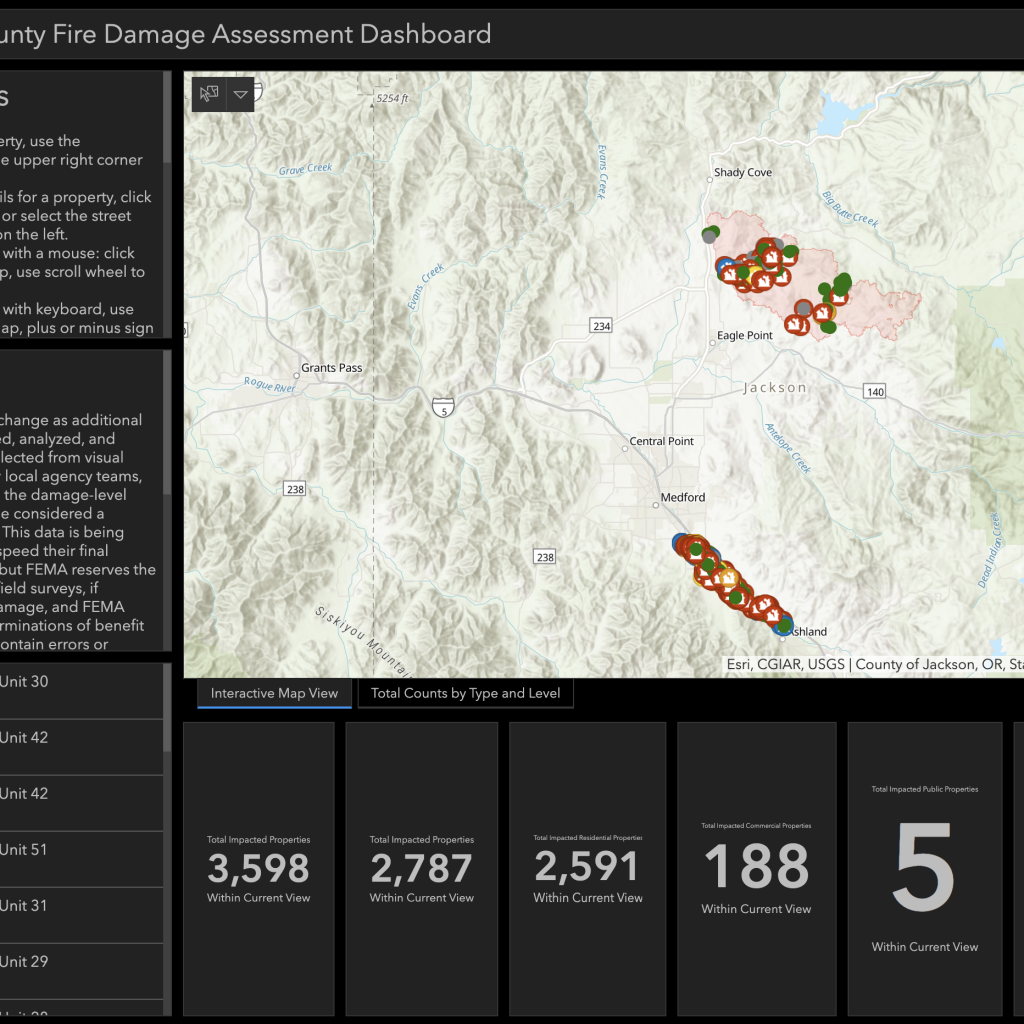
Damage Assessment information from the Almeda and Obenchain fires can now be explored via an online data dashboard, available via the Jackson County website at: www.jacksoncounty.org/damagedashboard.
This interactive mapping tool will allow anyone with internet access to quickly locate and view the extent of damage to individual properties. Making this information available online will safeguard health by reducing the need for people to visit hazardous burn sites. It will also save time and fuel by avoiding travel to perform a physical site inspection.
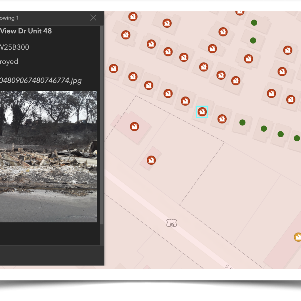
Relief providers, including FEMA and insurance companies, will be able to use the dashboard when processing claims. Loss claims typically can’t be approved until the damage is confirmed visually. The dashboard provides a street-view photo of assessed properties. It also provides the damage-level rating assigned to the property by local building officials. These damage ratings correspond to the FEMA damage categories, which rate properties on a 5-level scale from Unaffected to Destroyed. These categories affect the amount of financial assistance a property owner can receive from FEMA. “We have a long road of recovery ahead and assessing the full extent of damage is a critical step. This tool will help the county, state, and FEMA have the information needed to move as quickly as we can toward recovery,” shared FEMA Deputy Field Coordinating Officer Toney Raines.
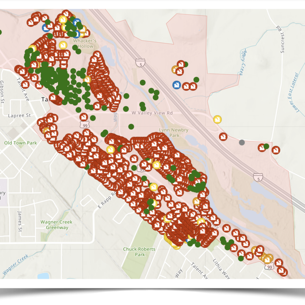
In addition to information for individual properties, the dashboard also provides overall statistics for the region. Total counts of all properties assessed within the Almeda and Obenchain burn areas are broken out by damage level and property type. Such information is valuable to government officials to help target relief and plan recovery efforts. “We hope that this tool will help to speed up the recovery effort and to bring some answers to those impacted by these fires,” shares EOC Director John Vial.
Built using dynamic GIS (Geographic Information System) software from ESRI, the dashboard can be viewed through most web browsers various devices. Even smartphone browsers will work, but the dashboard is best viewed on a large-screen computer monitor or tablet.
“Our County GIS team has worked tirelessly since the fires started to provide cutting-edge mapping and analysis tools to both first responders and damage assessment crews,” said Mark Decker, Technology Director for the County. “We’re pleased to be able to make such tools available to the general public as well.”
Data displayed on the dashboard is the latest available. Damage ratings and counts update automatically in real-time when data is added or corrected. As such, totals may change slightly over time. Great effort went into making the data as complete and accurate as possible, and we are continuing to improve data quality as new information becomes available. Dashboard users who discover errors or omissions in the data are encouraged to report them via a link in the online instructions.
By Mark Decker, Jackson County Technology Director

Advertisement